Maps that Changed Our World: 10 Remarkable Cartographic Milestones
Maps are more than geographical guides; they are windows to the past and powerful tools that have shaped our world. Throughout history, certain maps have had a profound impact, altering the course of events, sparking discoveries, and changing the way we perceive our planet.
These maps represent not only spatial knowledge but also the evolving collective wisdom of humanity, unveiling the stories behind their creation and the far-reaching consequences they ushered in.
Join us in this exploration of exploring ten remarkable cartographic milestones that have left an indelible mark on human history and forever changed our world.
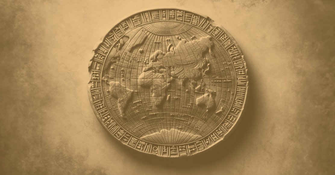
1. Eratosthenes' World Map
In the annals of cartography, Eratosthenes stands as a luminary from ancient Greece in the 3rd century BCE. His contributions to geography and mapmaking continue to astonish scholars even today.
Calculating Earth's Size: Eratosthenes' Remarkable Achievement
Eratosthenes was the first to accurately estimate the Earth's circumference, a feat that reshaped our perception of the world. Leveraging his profound understanding of geometry and astronomy, he calculated the Earth's size with remarkable precision, setting a milestone in cartographic history.
The Lost Map and Its Pioneering Nature
Although his original map is lost to time, historical accounts and reconstructions shed light on its pioneering characteristics. Eratosthenes' map, a cylindrical projection of the known world, showcased a level of accuracy unprecedented in its era.
It not only determined the Earth's size but also delineated climate zones, revolutionizing ancient geography.
Legacy and Impact on Cartography
Eratosthenes' map laid the groundwork for early geography and cartography. Its significance is profound as it provided the basis for subsequent mapmakers, including Ptolemy, whose world maps were influenced by Eratosthenes' groundbreaking work.
His methods of measurement and understanding of Earth's shape and size represented a monumental leap in human knowledge, shaping history and guiding the evolution of cartography.
2. Babylonian World Map
The Imago Mundi, an ancient Babylonian clay tablet dating back to the 6th century BCE, holds the distinction of being the world's first known surviving geographical representation.
This remarkable artifact offers a tantalizing glimpse into the worldview of the ancient Babylonians and their early efforts in mapmaking.
The Babylonian World Map, carved onto a small clay tablet, portrays a strikingly different perspective of the world compared to modern maps.
Unlike the familiar global projections we use today, the Babylonians depicted the known world as a flat, circular landmass encircled by a ring of water, symbolizing the "Great Sea." While the map's geographic accuracy may not align with modern standards, its historical significance is undeniable.
What sets the Babylonian World Map apart is its unique perspective. In the center, we find the city of Babylon, serving as the epicenter of the Babylonian worldview. This positioning reflects not just the geographic center but also the cultural and political significance of Babylon in the ancient world.
Surrounding Babylon are other cities, mountains, and bodies of water, all showcasing the Babylonians' understanding of the world within their reach.
The Babylonian World Map provides insights into how the ancient Babylonians perceived and interacted with their world. Beyond its geographical aspects, it is a testament to the societal, cultural, and cosmological factors that shaped the Babylonians' worldview.
This ancient map, although distant from modern cartography in terms of accuracy, remains a valuable piece of human history that sheds light on the earliest expressions of geographic knowledge and the human impulse to map the world around us.
3. Peutinger Map
The Peutinger Map, also known as the Peutinger Table, is a remarkable artifact from antiquity that offers a unique perspective on the Roman road network.
Created in the 13th century as a copy of a Roman original, this scroll-like map is one of the most comprehensive representations of the Roman road system that has survived.
The map is significant for its practicality, as it served as a guide for ancient travelers. It depicts a network of roads that connected various parts of the Roman Empire, from Britannia to India. These roads were vital for both military and civilian purposes, facilitating the movement of troops, goods, and ideas.
Among the notable locations depicted on the Peutinger Map are Rome, Constantinople, Antioch, and Londinium (London). The map provides insights into the vast expanse of the Roman Empire and its advanced infrastructure.
Today, it remains a valuable historical document, shedding light on the complexity of the Roman road system and its role in shaping the ancient world.
4. The Mercator Projection
The Mercator projection, developed by Gerardus Mercator in the 16th century, is a pivotal map projection that revolutionized navigation during the Age of Exploration. Mercator's innovative projection transformed the way sailors and navigators understood and traversed the world's oceans.
Mercator's contribution to cartography lies in his creation of a map projection that accurately represented lines of constant compass bearing as straight lines.
This feature made it easier for mariners to navigate with a constant course, following what are known as rhumb lines. These lines are ideal for practical navigation because they maintain a constant compass direction.
The practical implications of the Mercator projection are immense. Sailors and explorers could use the map to plan their voyages more efficiently, following straight courses on the map that corresponded to steady compass directions.
This accuracy in navigation not only made maritime travel safer but also facilitated the exploration and colonization of new lands. Mercator's projection remains a fundamental tool for navigation and remains one of the most recognizable map types in use today.
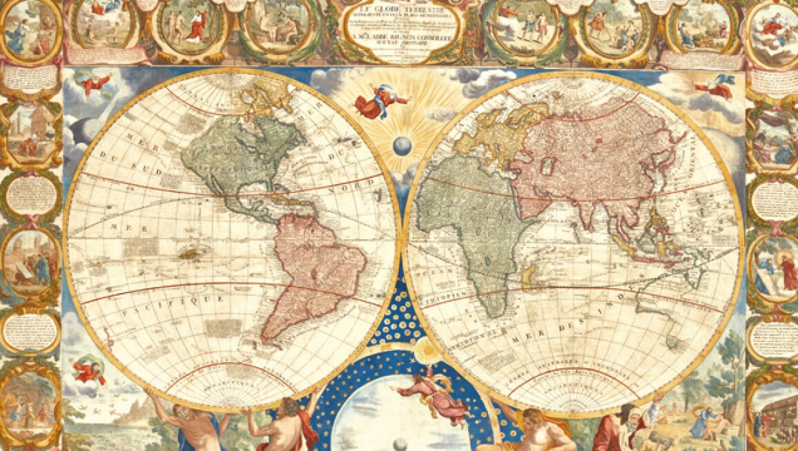
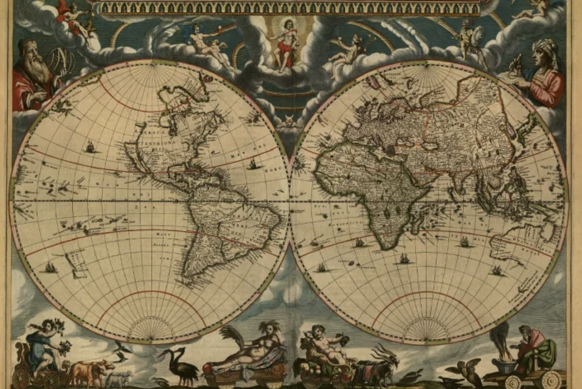
5. Atlas Maior
Joan Blaeu's Atlas Maior, crafted during the 17th century, is an awe-inspiring cartographic achievement that transcended its time.
This monumental atlas, often referred to as the "Great Atlas," was a masterful compilation of maps and geographical knowledge, aspiring to encompass the entirety of the known world. In doing so, it achieved an indelible mark in the evolving landscape of maps and atlases.
The profound impact of Blaeu's Atlas Maior extended far beyond the realm of cartography. With its exquisitely detailed maps and comprehensive geographical descriptions, this atlas became an invaluable resource for scholars, explorers, and those hungry for a deeper understanding of the world.
The atlas was instrumental in spreading information about distant lands and cultures, as well as sharing the latest discoveries of the era.
However, the Atlas Maior transcended its practical utility. It played a unique role in society, not solely as a tool for navigation or academic study but as a symbol of prestige and cultural refinement.
Possessing this opulent atlas signified both wealth and intellectual curiosity, a treasure gracing the collections of scholars and nobles, and adorning the libraries and studies of the European elite.
Joan Blaeu's Atlas Maior remains a testament to the historical reverence for maps and their enduring influence in shaping our understanding of the world.
6. Broad Street Cholera Map
Dr. John Snow's Broad Street Cholera Map, created in 1854, marked a groundbreaking moment in the history of epidemiology and public health. Snow, a British physician, developed a unique approach to visualize and understand the cholera outbreak in London during the mid-19th century.
His innovative map, which integrated both geographical and epidemiological data, was a critical milestone in pinpointing the source of the epidemic and curbing its spread.
At the heart of Snow's map were two key elements: the dot map and the Voronoi diagram. The dot map marked individual cholera cases with dots, each representing a life lost to the disease. Through meticulous observation and data collection.
Snow identified the clustering of these dots around a particular location: the Broad Street water pump. This finding laid the foundation for his revolutionary conclusion that contaminated water from the pump was the source of the cholera outbreak.
The impact of Snow's map extended far beyond cartography. It was instrumental in changing the course of public health practices.
By identifying the link between cholera outbreaks and contaminated water sources, Snow's work led to the removal of the Broad Street pump's handle, which subsequently curtailed the epidemic.
This pioneering approach to mapping diseases laid the groundwork for modern epidemiology, emphasizing the importance of data visualization and spatial analysis in understanding and combating health crises.
John Snow's Broad Street Cholera Map remains a testament to the powerful intersection of cartography, science, and public welfare.
7. Peters World Map
Arno Peters, a German historian and cartographer, rocked the world of mapmaking with his eponymous Peters World Map. Introduced in 1974, this map marked a significant departure from the traditional Mercator projection and aimed to correct what Peters saw as a Eurocentric bias in cartography.
The Peters Map was a radical reimagining of the world's portrayal. Rather than adhering to the Mercator projection's distortion, which significantly enlarged countries near the poles, the Peters Map utilized an equal-area projection.
This projection preserved the relative sizes of landmasses, making it one of the first world maps to display an accurate depiction of countries' true proportions.
Beyond its cartographic innovations, the Peters Map made a profound socio-political statement. Peters believed that the traditional Mercator projection perpetuated an unfair view of the world, with a focus on European countries.
By introducing an equal-area projection, Peters aimed to promote a more equitable representation of the globe, highlighting the vastness of African, Asian, and South American landmasses, which were often underrepresented on Eurocentric maps.
While the Peters Map sparked considerable debate and controversy, it undoubtedly had a lasting impact on the way we perceive and understand our world, challenging centuries-old cartographic conventions and advocating for a more inclusive portrayal of Earth's geography.
8. The Cantino Planisphere
The Cantino Planisphere is a significant artifact in the history of cartography, reflecting the Age of Exploration's fervor and innovation.
Created around 1502, this map is one of the earliest representations of the world to illustrate the recent geographical discoveries and voyages that were transforming the European understanding of global geography.
The planisphere highlights several aspects of historical significance. First, it provides a snapshot of the coastlines of Europe, Africa, and parts of the Americas during a crucial period of exploration.
This visual record captures the geographical knowledge of the time, including coastlines that were recently explored and still being charted.
The Cantino Planisphere serves as a bridge between the medieval mappaemundi and the more modern world maps that would emerge during the Renaissance and Age of Exploration.
One of the most notable features of the Cantino Planisphere is its connection to Portuguese exploration and commerce. The map is believed to have been made in Portugal and contains significant Portuguese influence, as indicated by the presence of Portuguese flags and the naming of newly discovered locations.
This connection underscores Portugal's prominent role in early exploration, particularly during the Age of Discovery. The Cantino Planisphere is a testament to the adventurous spirit of the time and the pivotal role played by maps in shaping the course of history, exploration, and global trade.
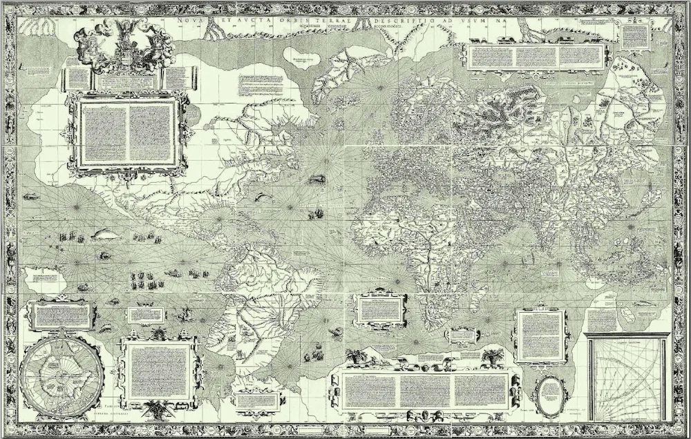
9. Waldseemuller Map
Martin Waldseemüller's World Map of 1507, also known as the Waldseemüller Map, is a remarkable historical cartographic artifact that reshaped the European understanding of the world during the Renaissance.
This map holds a special place in history for its audacious depiction of the world's geography and its bold naming of a new continent – America.
At its core, the Waldseemüller Map represents a major shift in European cartography. It is one of the first maps to illustrate the concept of North America as a distinct landmass, separate from Asia.
This distinction reflects the evolving understanding of the New World due to Christopher Columbus's voyages and Amerigo Vespucci's explorations.
The map even bestows the name "America" upon this newfound continent, an homage to Amerigo Vespucci's contributions to geography. In essence, the Waldseemüller Map marks the birth of the modern concept of America.
The impact of the Waldseemüller Map on European understanding of the world cannot be overstated. It provided a template for subsequent maps and influenced the development of geographic knowledge. The map was both a reflection of its time and a catalyst for future exploration and mapmaking.
It embodied the Renaissance spirit of curiosity, discovery, and intellectual daring, ultimately paving the way for a new era of global exploration and understanding.
Waldseemüller's map is not just a representation of the known world; it is a testament to the human desire to expand horizons, challenge conventional wisdom, and chart the unknown.
10. The Mappa Mundi
The Mappa Mundi, a magnificent medieval map, offers us a unique glimpse into the world as it was perceived during the Middle Ages.
This intricate and beautifully illuminated cartographic creation, dating back to the 13th century, serves as both a geographical map and a cultural artifact that encapsulates the medieval mindset.
The Mappa Mundi is not just a map in the modern sense; it's a comprehensive representation of the known world as envisioned in the 13th century.
This circular map is a breathtaking blend of geography, theology, and mythology, illustrating the Earth's physical geography alongside religious and historical elements.
Key informations about the Mappa Mundi:
|
Attribute |
Description |
|---|---|
|
Name |
Mappa Mundi |
|
Date |
13th century |
|
Type |
Medieval world map |
|
Location |
Hereford Cathedral, Hereford, England |
|
Purpose |
Comprehensive representation of the known world in the Middle Ages |
|
Features |
Circular map blending geography, theology, and mythology |
|
Depictions |
Exotic creatures, biblical events, cultures, and peoples |
|
Central Theme |
Jerusalem at the center, surrounded by diverse geographical regions |
|
Cultural Significance |
Reflection of medieval worldview and mindset |
The map includes exotic creatures, biblical events, and a variety of cultures and peoples. It reflects the medieval view of the world as a place filled with wonder, mystery, and divine intervention.
This medieval map, preserved in Hereford Cathedral, stands as a testament to the medieval understanding of the world. It's a visual narrative of the human journey, with Jerusalem at its center and various exotic locales and creatures scattered around.
The Mappa Mundi captures the imagination of historians, cartographers, and art enthusiasts alike, allowing us to step into the shoes of medieval minds and experience a world where cartography, religion, and culture were inextricably intertwined.
Cartography's Timeless Influence
As we journeyed through the ten remarkable maps that have left an indelible mark on history, it's evident that cartography has been a powerful force in shaping human understanding of the world.
These maps, spanning centuries and cultures, reveal the evolving relationship between humans and their environment, reflecting how geography, exploration, and technology have progressed.
From the groundbreaking accuracy of Eratosthenes' world map to John Snow's crucial epidemiological insights with the Broad Street Cholera Map, each map represents a pivotal moment in history.
Whether it's challenging Eurocentric worldviews, defining national borders, or preserving the knowledge of a bygone era, these maps have played a fundamental role in humanity's development.
While the era of paper maps has given way to digital navigation and personalized cartography, the enduring importance of maps remains.
Today, platforms, such as MixPlaces, allow users to create personalized maps, etching their own stories and cherished memories into the cartographic fabric of their lives.
In doing so, we carry forward the legacy of the pioneering cartographers who came before us, shaping the course of history one map at a time.