Top 10 Map Graphic Design Ideas & Inspiration
In today's world, graphic design plays a crucial role in shaping the way we perceive and interact with maps. It's not just about plotting locations; it's about making maps visually engaging and easy to decipher.
The fusion of graphic design and cartography has opened up a world of possibilities, transforming maps into more than just functional tools—they're now captivating works of art. Enter MixPlaces, an intersection where the artistry of graphic design meets the precision of cartography.
MixPlaces represents a unique blend, weaving together the creative aspects of graphic design with the scientific precision of cartography. It's more than just a platform; it's a canvas that empowers users to explore their creativity while crafting custom maps.
The marriage of MixPlaces and cartography symbolizes the synergy between design aesthetics and spatial accuracy, offering a gateway for users to infuse their personal touch into cartographic masterpieces. So, let's embark on this journey into the fascinating realm where design meets maps.
Lessons from Beautiful Maps
Maps are more than geographical representations; they are visual stories that captivate and guide us through intricate landscapes. In this exploration we embark on a visual journey uncovering the artistry and design techniques that elevate cartography.
The best design technique are:
|
Design Technique |
Description |
|---|---|
|
Negative Space Mastery |
Effective use of unmarked space around map elements, providing clarity and visual hierarchy. |
|
Vivid Color Palette |
Skillful selection and application of colors to convey information and evoke emotions effectively. |
|
Typography Excellence |
Thoughtful use of fonts and text placement for legibility, aesthetics, and enhancing map comprehension. |
|
Perspective Enhancement |
Incorporation of unique perspectives to add depth and visual interest, transcending traditional 2D maps. |
From the subtle mastery of negative space to the vivid power of colors, typography, and perspective, we delve into the nuanced elements that shape maps into more than mere navigational tools.
Join us as we uncover the secrets behind stunning maps that ingeniously blend cartography with graphic design principles, inspiring us to see the world through a new lens of creativity and clarity.
Emphasizing Negative Space for Clarity
Negative space, often overlooked in map design, plays a crucial role in enhancing clarity and guiding the viewer's focus. By purposefully utilizing the empty spaces on a map, cartographers can create a more intuitive and comprehensible representation of geographic information.
Negative space, or the areas around and between map elements, can help reduce visual clutter and emphasize essential features.
For example, leaving ample negative space around labels and symbols prevents overcrowding, making it easier for users to identify and understand geographical details. The deliberate use of negative space aids in creating a more balanced and aesthetically pleasing map.
Utilizing Color Associations for Quick Understanding
Color, as a powerful tool in map design, goes beyond mere aesthetics, serving as a visual language that facilitates quick comprehension. Strategic use of color associations enables map designers to convey information efficiently and create visually stunning representations of geographic data.
Different colors carry specific meanings in cartography, helping users interpret various aspects of the terrain.
Warm colors may signify elevated areas, while cool tones represent bodies of water. Understanding this color language allows designers to communicate complex information in an accessible manner, enhancing the overall usability of the map.
Typography for Character and Clarity
Typography plays a pivotal role in map design by influencing the character and clarity of the information presented. The choice of fonts, their sizes, and placements can significantly impact how users engage with and interpret geographic data.
Clear, legible fonts contribute to improved readability, ensuring users can easily identify landmarks, cities, and other key features. Typography that aligns with the map's theme enhances the overall aesthetic appeal, creating a cohesive and engaging user experience.
Minimalist Elements for Contemporary Maps
Minimalist design principles emphasize simplicity and clarity, and when applied to maps, they can lead to a more intuitive user experience. Stripping away unnecessary details allows the essential information to stand out, making it easier for users to grasp key geographic features.
Minimalist maps are not only aesthetically pleasing but also contribute to a more user-friendly and accessible mapping experience by removing visual noise and presenting information in a clean, straightforward manner.
Adding Perspective to Bring Maps to Life
Introducing perspective in map design adds depth and a sense of realism. Departing from traditional 2D representations allows users to engage with the map in a more immersive way, providing a unique and enriched perspective of the geographical information.
Examining maps that incorporate three-dimensional elements showcases the impact of perspective. Whether through isometric projections or terrain modeling, these maps bring the geography to life, offering users a more dynamic and engaging exploration experience.
Leveraging Scale to Guide the Viewer
Scale is a critical element in map design, influencing how users perceive the size and relationships between geographical features. By effectively utilizing scale, map designers can guide the viewer's focus, emphasizing specific details and providing context to the overall layout.
Maps that skillfully leverage scale highlight its importance in guiding the viewer. Whether through varying font sizes for labels or adjusting the size of symbols, these maps use scale to emphasize certain features, ensuring a more nuanced understanding of the geographic information presented.
The Importance of Linework in Map Design
The linework in map design, encompassing the lines and strokes used to represent features, holds significant importance. It defines boundaries, outlines shapes, and contributes to the overall visual hierarchy of the map.
Maps with meticulous linework showcases its role in enhancing cartographic precision. Whether illustrating coastlines, borders, or intricate geographical details, strong linework contributes to the map's clarity and ensures accurate representation of the depicted features.
Consistency in Illustration Style
Consistency in illustration style is essential for creating a cohesive and visually appealing map. A unified design aesthetic ensures that all elements, including symbols, colors, and fonts, work together harmoniously to convey information in a seamless manner.
A unified design aesthetic not only enhances the overall aesthetics but also facilitates a smoother and more intuitive user experience, allowing users to navigate the map with ease.
Adding Texture for Depth and Feeling
The incorporation of texture in map design adds depth and a tactile quality, enhancing the overall visual experience. Texture can represent various elements, such as terrain features, vegetation, or urban landscapes, providing users with a more immersive understanding of the geography.
Maps that skillfully integrate textures demonstrate how this design element can create a sense of depth and feeling. Whether using subtle shading to represent elevation or intricate textures for specific land features, textured maps contribute to a more engaging and emotionally resonant mapping experience.
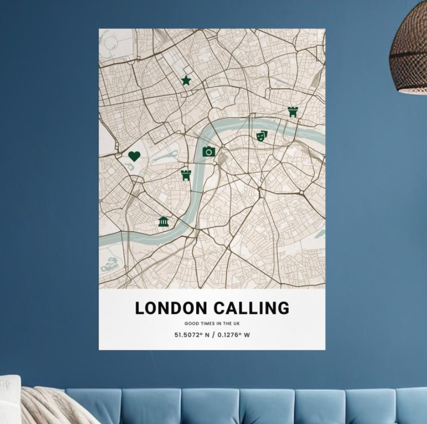
Connecting with Familiar Imagery
Iconography, or the use of symbols and images, plays a crucial role in conveying information on maps. Familiar imagery helps users quickly recognize and understand key features, landmarks, or points of interest.
Examining maps that incorporate iconic imagery showcases the effectiveness of using symbols and icons. Whether representing mountains, buildings, or other features, well-designed iconography enhances the map's communicative power, allowing users to easily interpret and navigate the geographical information.
Top 10 Map Design Ideas & Inspiration
Highlighting the top 10 most innovative map designs provides inspiration for cartographers and designers.
These examples push the boundaries of traditional map design, showcasing novel approaches, creative techniques, and cutting-edge technologies that redefine how geographic information can be presented and explored.
By drawing inspiration from outstanding maps, designers (like yourself) can contribute to the evolution of map design, creating visually compelling and user-friendly representations of geographic data.
1. Urban Street Art Map
Unveil the vibrant street art scene by meticulously curating a map that goes beyond pinpointing graffiti locations. Offer detailed descriptions of the artwork, artist biographies, and their inspiration behind each piece.
Incorporate multimedia elements such as images or videos showcasing the evolution of these urban masterpieces, providing a deeper understanding of the cultural impact of street art.
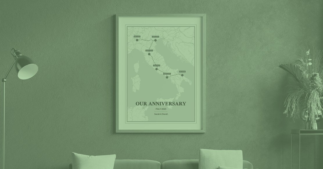
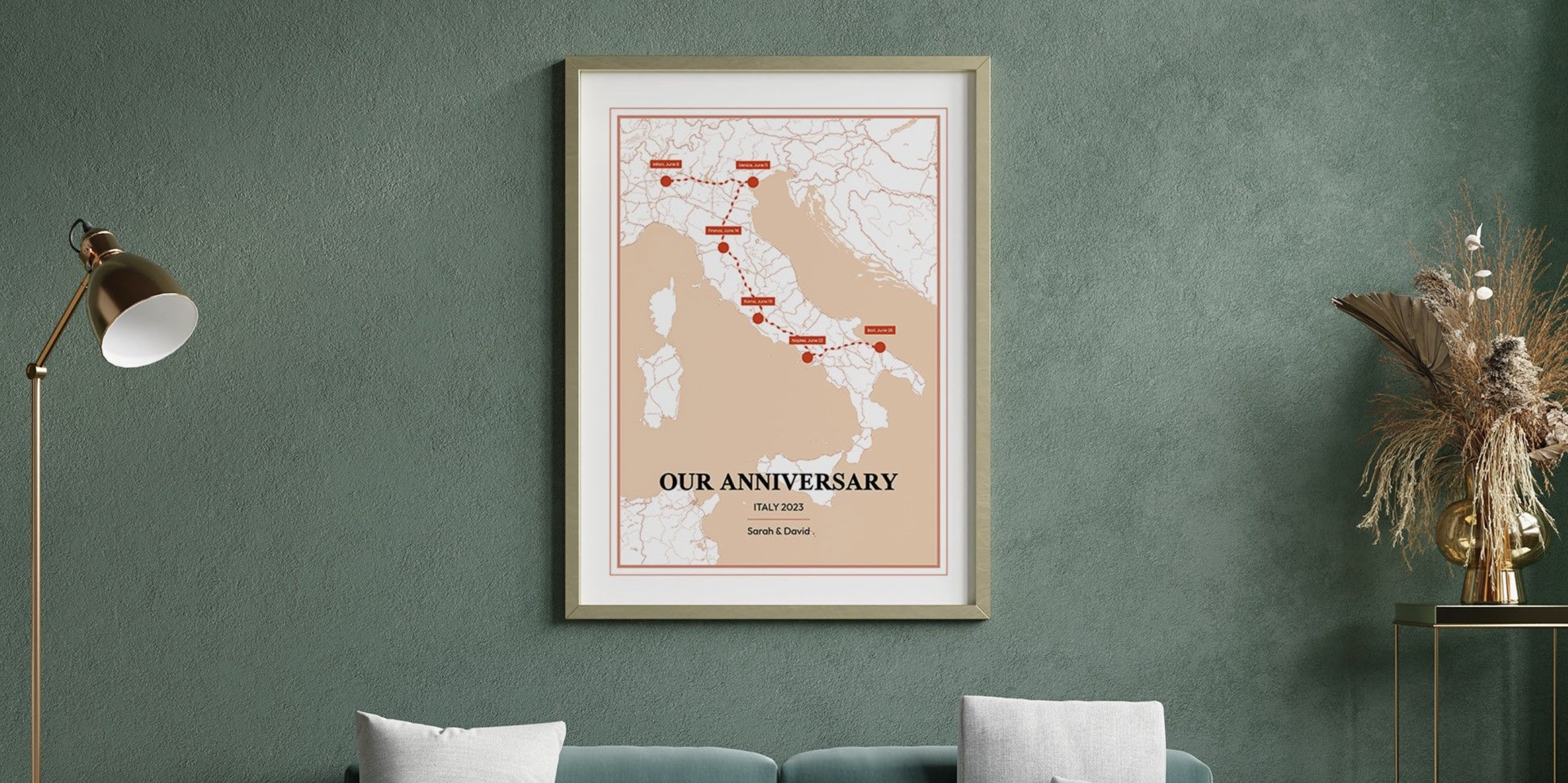
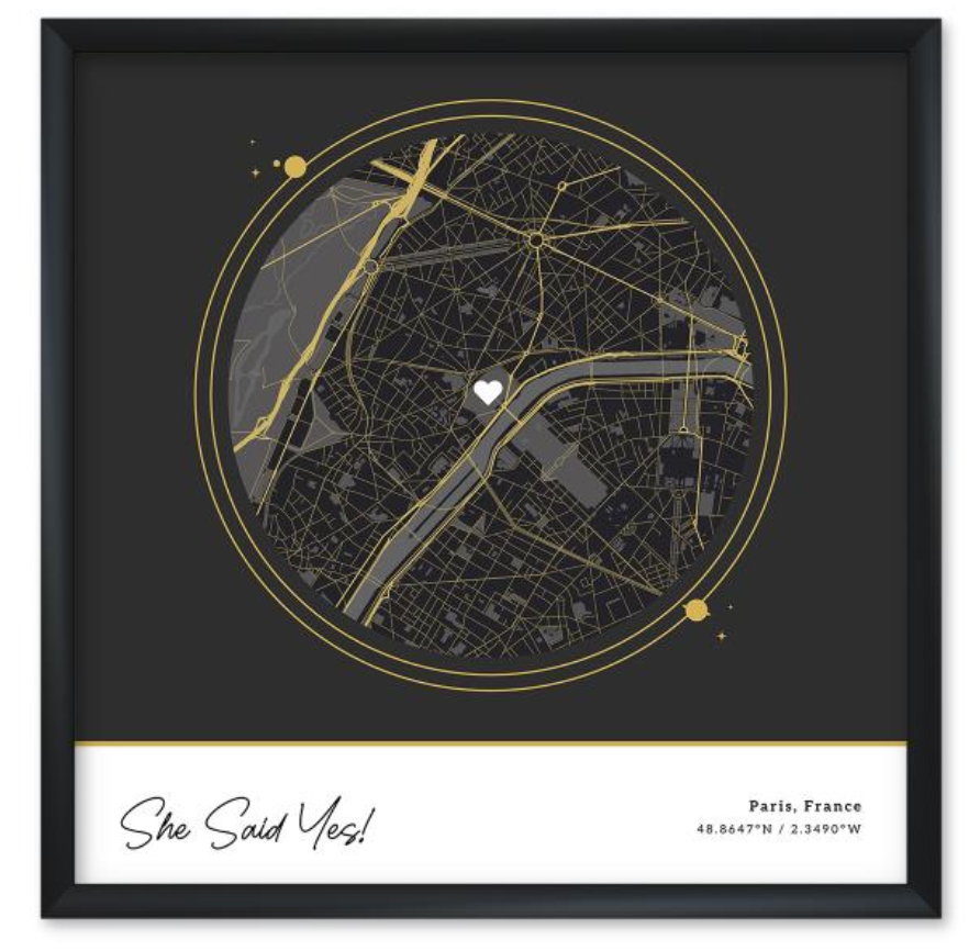
2. Memory Lane Map
Embark on an emotional journey through personal milestones by mapping significant life events and cherished memories. Enhance the storytelling by adding anecdotes, photographs, or videos linked to each location.
Encourage users to share their own experiences or memories tied to these places, fostering a sense of community and nostalgia.
3. Culinary Adventure Map
Craft an immersive culinary guide capturing the essence of local gastronomy. Go beyond listing restaurants and cafes; feature food trails, farmer's markets, food festivals, and even cooking classes.
Share stories behind iconic dishes, include recipe suggestions, and spotlight chefs or artisans to provide a comprehensive culinary exploration.
4. Outdoor Exploration Map
Create an outdoor enthusiast's dream guide by showcasing hiking trails, camping sites, and natural wonders. Enhance the experience by providing detailed trail difficulty levels, terrain descriptions, wildlife encounters, and safety tips.
Incorporate multimedia elements like 360-degree panoramic views or user-generated photos to showcase the beauty of each location.
5. Literary Tour Map
Transport literature enthusiasts into their favorite stories by mapping locations from renowned books or authors' lives. Delve into the historical context of each place, including excerpts from the novels, quotes, or character references.
Encourage readers to explore the narratives by adding trivia quizzes or interactive elements related to the literature.
6. Art and Culture Map
Uncover the vibrant cultural tapestry of a city by highlighting art galleries, museums, theaters, and cultural events.
Showcase ongoing exhibitions, artist residencies, live performances, or behind-the-scenes glimpses into the creative process. Introduce interactive elements like virtual tours or artist interviews to engage users in the local art scene.
7. Historical Landmarks Map
Immerse users in the rich history of a region by spotlighting significant landmarks, monuments, and heritage sites.
Offer in-depth historical narratives, archival photographs, and audiovisual material to bring the past to life. Encourage users to contribute personal anecdotes or historical facts, fostering a collaborative platform for preserving heritage.
8. Coffee Shop Hop Map
Create a comprehensive guide for coffee connoisseurs, showcasing not just coffeehouses but also detailing brews, tasting notes, and ambiance.
Incorporate coffee brewing methods, origin stories of coffee beans, and interviews with baristas. Introduce a user-generated review system to encourage community engagement and recommendations.
9. Music Venue Map
Navigate through a city's music scene by mapping live music venues, iconic performance spaces, and recording studios. Highlight diverse genres, upcoming gigs, artist profiles, and historical significance behind each venue.
Offer interactive features such as live streaming of performances or exclusive interviews with musicians to immerse users in the local music culture.
10. Hidden Gems Map
Unveil the unconventional and hidden treasures in a city or region that are often overlooked. Showcase secret viewpoints, unique architecture, or quirky attractions with detailed descriptions and user-generated content.
Introduce interactive challenges or scavenger hunts, encouraging users to explore and share their discoveries, fostering a community of exploration enthusiasts.
Design Trends in Modern Map Making
In the digital era, map design has witnessed a profound transformation, embracing innovative trends that redefine the way we interact with spatial information.
Contemporary map designers are increasingly integrating technology-driven elements to create maps that are not only functional but also engaging and user-friendly.
Interactive Maps
Interactive maps have revolutionized how users engage with geographical data. By allowing users to interact, manipulate, and customize map content, these maps provide an immersive experience.
From zooming in on specific regions to toggling between various layers of information, interactivity fosters greater engagement and customization, catering to diverse user preferences and needs.
Mobile-Friendly Designs
With the proliferation of mobile devices, maps are adapting to smaller screens and touch interfaces. Mobile-friendly designs prioritize responsive layouts and intuitive touch controls, ensuring seamless navigation and readability on smartphones and tablets.
The emphasis on mobile compatibility allows users to access maps on-the-go, facilitating real-time location-based services and enhancing user experiences.
Integration of Augmented Reality (AR)
The integration of augmented reality into map design presents a new dimension of exploration. AR overlays digital information onto the physical world, providing users with contextual information about their surroundings in real-time.
By leveraging smartphone cameras or AR-enabled devices, users can experience enriched navigation, historical overlays, or real-time data superimposed on the environment, revolutionizing how we perceive and interact with geographical spaces.
These trends in modern map making underscore a shift towards user-centric design and technological innovation.
They offer enhanced functionality, accessibility, and engagement, transforming maps from static representations to dynamic, interactive tools that cater to the evolving needs and expectations of users in today's digital landscape.
MixPlaces: Creating Custom Maps
MixPlaces is more than just a mapping tool; it's a creative haven for crafting personalized maps. Our innovative platform offers a seamless experience for users seeking to design custom maps that resonate with their unique stories and adventures.
MixPlaces stands out for our user-friendly interface, enabling effortless customization. We streamline the process of creating personalized maps, allowing users to easily add markers, routes, and notes. Our intuitive design fosters creativity without overwhelming users with technical complexities.
Some benefits of designing custom maps with MixPlaces are:
-
MixPlaces offers an intuitive and easy-to-navigate interface, ensuring a smooth and hassle-free map creation process.
-
We simplify the customization of maps, allowing users to add markers, routes, and notes effortlessly.
-
Users can create personalized maps with ease, thanks to our streamlined design, reducing complexities often associated with map-making tools.
-
MixPlaces provides an accessible and interactive approach to designing maps, catering to users with varying levels of cartography skills.
-
We empower individuals, regardless of technical expertise, to craft personalized maps that resonate with their unique stories and adventures.
-
Unlike traditional cartography tools, MixPlaces offers a more refreshing and modern take on map design, making the process engaging and enjoyable.
-
Our platform bridges the gap between creativity and technical aspects, allowing users to focus on their creative ideas without getting overwhelmed by complexities.
-
With our simple yet flexible features, MixPlaces redefines map-making, offering a balance between user-friendly design and customization options.
Unlike traditional cartography tools, MixPlaces offers a refreshing take on map design. We provide a more accessible and interactive approach to map creation, empowering users who might not have specialized cartography skills.
Our platform's simplicity and flexibility redefine the map-making experience, bridging the gap between creativity and technicality. This contrast makes MixPlaces an appealing choice for individuals seeking a more intuitive and user-centric map design solution.

The Harmony of Cartography and Design
In our modern landscape, the roles of cartography and graphic design persist as pillars of visual communication. Beyond their traditional functions, these disciplines continually evolve, offering innovative ways to interpret, represent, and interact with spatial information.
Cartography's precision in mapping meets the creative storytelling of graphic design, fostering a unique synergy that shapes how we perceive and navigate our world.
Embracing a diverse array of influences enriches the design process. The fusion of cartography and graphic design exemplifies the benefits of drawing inspiration from multiple disciplines.
Through this amalgamation, designers gain fresh perspectives, enabling them to infuse creativity and depth into their creations.
Learning from various sources fosters a dynamic, adaptive approach to design, encouraging experimentation and pushing the boundaries of visual storytelling.
The enduring relevance of cartography and graphic design lies not only in their historical significance but also in their adaptive nature.
Their harmonious integration empowers designers to craft compelling narratives, fostering a deeper understanding of our surroundings and paving the way for future innovations in visual communication.